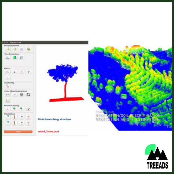
TREEADS Detailed Forest Mapping tool (FORESTMAP), is an asset that takes advantage of three-dimensional reconstruction using satellite or low-cost photogrammetry together with data coming from drones and LiDAR systems, offering a complete product in forest areas. This product identifies what is land and vegetation by determining the different heights, in order to evaluate possible fire hazards. As a result, FORESTMAP generates a forest inventory with all the parameters required.
If you wish to learn more about this technology and/or purchase it, add it to your Shopping Cart and proceed to checkout. You will not be charged. When this procedure is completed you will receive the contact information of the party responsible for this technology.