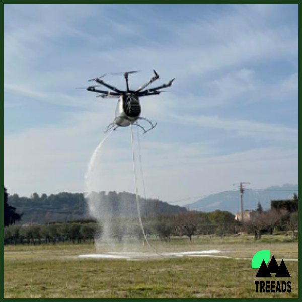
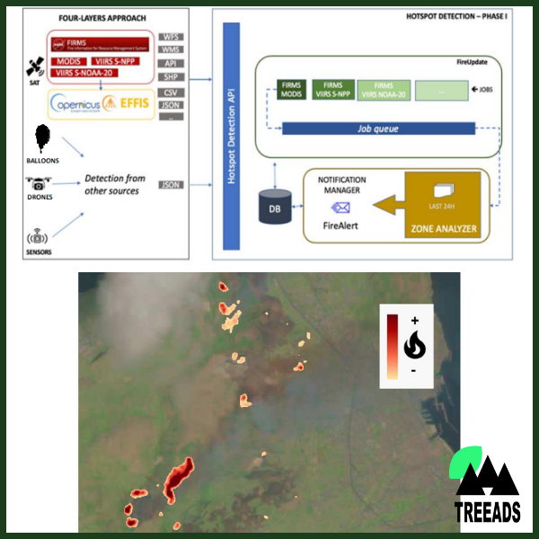
A four-layer detection and response platform aggregating information from various sensors and altitudes to provide timely, accurate, and comprehensive information regarding emerging wildfire incidents, along with aerial fire extinguishing services. The integrated information enhances situational awareness and supports applications like hotspot detection, object recognition, and optimal route planning for first responders. Hotspot detection, for instance, combines data from satellites, high-altitude balloons, low and medium-altitude UAVs, and other sensors to deliver reliable information, whereas terrain information from LiDAR sensors is utilized to determine safe routes for firefighters. The platform also integrates novel UAV-aided firefighting solutions for aerial fire suppression and extinguishing for swift and effective response.
Four-Layered Enhanced Detection, Targeting and Extinction System
Related products
-
Artificial Intelligence & Machine Learning
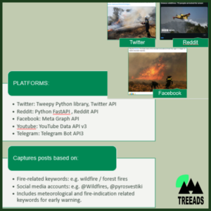
Social Media Analysis Framework
-
Austrian
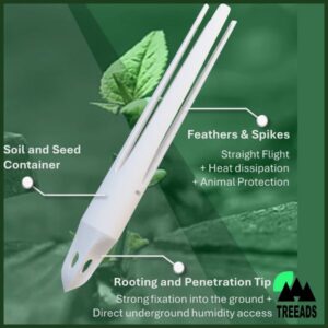
Seed container capsules (SCC)
-
Restoration and Adaptation
DSS restoration module